USGS Nebraska Water Science Center
Emerging Science
Case Study: Assessing Geologic Controls on Groundwater Discharge in the Loup River Basin of Nebraska through the Use of Aerial Thermal-Infrared Imagery
Streamflows in the Loup River basin are sensitive to groundwater withdrawals because of the close hydrologic connection between groundwater and surface water. Streams in the Loup River basin are known to receive a combination of focused discharge (groundwater discharge as springs) and diffuse discharge. Areas of focused groundwater discharge had not been extensively mapped previously; furthermore, the effects of various climatic and land-use changes on groundwater discharge patterns are currently unknown.
We are studying the temporal and spatial characteristics of surface-water/groundwater interaction within the Loup River basin in cooperation with the Upper and Lower Loup Natural Resources Districts and the Nebraska Environmental Trust. Our goals are to
- examine the spatial and temporal characteristics of groundwater discharge in Loup River Basin,
- use aerial thermal infrared imagery to understand patterns of focused and diffuse groundwater discharge, and
- assess temporal changes in groundwater discharge using coupled groundwater/surface-water gages.
Aerial Thermal Infrared Imagery and Data
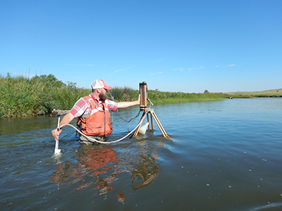
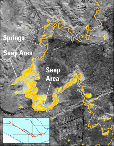
Aerial thermal-infrared imagery was collected over the two stream reaches prior to onset of ice in late 2015. This aerial imagery is used to identify locations of focused groundwater discharge and assess spatial patterns for entire stream systems. During that time, warm thermal anomalies in stream-surface temperatures indicated areas of focused groundwater discharge. Early results indicating zones of focused groundwater discharge were detected along the Dismal River, the North Fork of the South Loup, and the upper South Loup River.
Most points of focused groundwater discharge were typically small (less than 0.1 cubic feet per second); however, some focused discharges into the Dismal River exceeded 2 cubic feet per second.
Groundwater Discharge
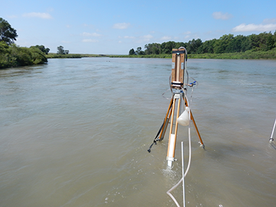
A series of focused groundwater discharge points was detected downstream from the USGS streamgage at Arnold, Nebr. Here, the South Loup River has incised into Pliocene-age gravel deposits and, along a 15-mile reach, the cumulative groundwater discharge increases streamflow by more than 100 percent. Prior to onset of ice along this reach, data collected using a self-logging temperature sensor showed the thermograph was shifted towards higher temperatures when compared to thermographs from other stream reaches, indicating that groundwater discharge constituted a larger proportion of total streamflow. Stream surface temperatures were extracted from the aerial thermal-infrared imagery temperature grid and plotted against distance below the streamgage at Arnold, Nebr.
These data indicate that a substantial increase in the groundwater discharge component of streamflow began above the points of focused groundwater discharge mapped downstream.
For More Information
Please visit the Groundwater/Surface-Water Interactions in the Loup River Basin web site
or contact the Project Chief:
Chris Hobza
402.328.4133
[email protected]