 The Platte River Program The Platte River Program
Color-infrared (CIR) Digital Orthophotos
Download Now!
Individual orthophotos, made from aerial photographs taken by the Bureau of Reclamation in August 1998, have been compressed using MrSID software from LizardTech. MrSID compressed images may be viewed using a free viewing software package available from LizardTech. You can also download software extensions from LizardTech that will allow you to use MrSID images in Adobe Photoshop.
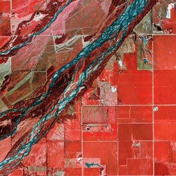
The original digital images averaged approximately 48Mb each. The MrSID
compressed images are approximately 2.2Mb each. The images were archived
for download with their corresponding world file using WinZip.
|