High Plains Aquifer Water-Level Monitoring Study
Water-Level Changes in the High Plains Aquifer—Predevelopment to 1993
By Jack T. Dugan and Dale A. Cox
U.S. Geological Survey
Water-Resources Investigations Report 94-4157
Lincoln, Nebraska
1994
Abstract
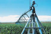
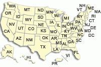
Regional variability in water-level change in the High Plains aquifer underlying parts of South Dakota, Wyoming, Nebraska, Colorado, Kansas, New Mexico, Oklahoma, and Texas results from large regional differences in climate, land use, and ground-water withdrawals for irrigation. From the beginning of significant development of the High Plains aquifer for irrigation (1940) to 1980, substantial water-level declines have occurred in several areas. The estimated average area-weighted water-level decline from predevelopment to 1980 for the High Plains was 9.9 feet, an average annual decline of about 0.25 foot. Declines exceeded 100 feet in some parts of the Central and Southern High Plains. Declines were much smaller and less extensive in the Northern High Plains, largely as a result of later irrigation development.
Since 1980, water levels in those areas of large declines in the Central and Southern High Plains have continued to decline, but at a much slower annual rate. The estimated average area-weighted water-level decline from 1980 to 1993 for the entire High Plains was 2.09 feet, which is an average annual decline of about 0.16 foot. The slower rate of decline since 1980, in relation to the rates prior to 1980, is associated partly with above-normal precipitation and a decrease in the average ground-water application rates for irrigated agriculture. Water-conserving practices and technology, in addition to reductions in irrigated acreages in areas of large consumptive irrigation requirements, contributed to the decrease in ground-water withdrawals for irrigation.
Water-level declines exceeding 20 feet since 1980, however, are widespread in parts of southwestern Kansas, east-central New Mexico, and the Oklahoma and Texas Panhandles. Widespread declines of 10 to 20 feet and exceeding 20 feet in smaller areas occurred in northeastern Colorado, northwestern Kansas, southwestern Nebraska, and the Nebraska Panhandle from 1980 to 1993. Water-level rises exceeding 20 feet occurred in the extreme Southern High Plains in Texas where precipitation was much greater than normal from 1981-92. Widespread water-level rises of 10 to 20 feet occurred in southeastern and southcentral Nebraska during the same period in association with above-normal precipitation.
The average area-weighted water-level in the High Plains rose 0.21 foot from 1992 to 1993 in apparent association with average area-weighted precipitation that was 2.80 inches above normal in 1992. Water-level rises of 3 or more feet from 1992 to 1993 were widespread in eastern and southern Nebraska, northwestern and south-central Kansas, and the southern two-thirds of the Southern High Plains of Texas. All of these areas of rise coincide with areas of well-above normal precipitation in 1992. The large rises in some of these areas, particularly in the Southern High Plains of Texas, may be partly the result of delayed recharge from above-normal precipitation in 1991 in association with the well-above normal precipitation in 1992.
Water levels continued to decline from 1992 to 1993 in northeastern Colorado, southwestern Nebraska, southwestern Kansas, the central Panhandle of Oklahoma, the northern Panhandle of Texas, and the northern part of the Southern High Plains. The size of the area and magnitude of these declines, however, appear to be considerably smaller than in previous years.
 This report (WRIR 94-4157) is available online. This report (WRIR 94-4157) is available online.
To obtain a copy of this report, please contact:
USGS Nebraska Water Science Center
5231 South 19th Street
Lincoln, Nebraska 68512-1271
Phone (402) 328-4100
FAX (402) 328-4101
Email: [email protected]
 Back to High Plains Aquifer main page Back to High Plains Aquifer main page
|