High Plains Aquifer Water-Level Monitoring Study
Water-Level Changes in the High Plains Aquifer--Predevelopment to 1990
By Jack T. Dugan and Donald E. Schild
U.S. Geological Survey
Water-Resources Investigations Report 91-4165
Lincoln, Nebraska
1992
Abstract
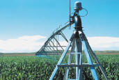
Changes in water levels in the High Plains aquifer underlying parts of South Dakota, Wyoming, Nebraska, Colorado, Kansas, New Mexico, Oklahoma, and Texas result from the variability of precipitation, land use, and ground-water pumpage. From the beginning of development of the High Plains aquifer to 1980, water levels declined throughout much of the area. These declines exceeded 100 feet in parts of the central and southern High Plains. For 1980 to 1990, patterns of water-level change were more variable. Large areas of intense irrigation development in Kansas, New Mexico, Oklahoma, and Texas had declines ranging from 7.5 feet to more than 15 feet. Additional large areas with 7.5 to 15 feet of decline were present in northeastern Colorado, southwestern Nebraska, and in Box Butte County, Nebraska.
Water levels were either stable or rising in the remainder of the High Plains. Large areas in Texas and eastern Nebraska had rises of more than 7.5 feet. The average area-weighted water-level change from 1980 to 1990 was -1.04 feet compared to -9.9 feet from predevelopment to 1980. This relatively small decline since 1980, in relation to the declines prior to 1980, was associated with a decrease in ground-water application for irrigated agriculture and above-normal precipitation throughout the High Plains from 1981 through 1989.
Water-level changes across the High Plains from 1989 to 1990 were a continuation of the variability observed in previous years; however, areas of declines were more prevalent than areas of rise. Declines throughout much of the Northern High Plains were associated with well below-normal precipitation in that area during 1989. Declines also continued throughout much of the intensely developed irrigation areas of the Texas High Plains. Rises associated with above-normal precipitation during 1989, however, occurred in parts of southwestern Kansas where significant long-term declines had occurred. The average area-weighted change from 1989 to 1990 in the High Plains was -0.63 foot, largely attributable to declines in Nebraska and Texas.
 This report (WRIR 91-4165) is available online. This report (WRIR 91-4165) is available online.
To obtain a copy of this report, please contact:
USGS Nebraska Water Science Center
5231 South 19th Street
Lincoln, Nebraska 68512-1271
Phone (402) 328-4100
FAX (402) 328-4101
Email: [email protected]
 Back to High Plains Aquifer main page Back to High Plains Aquifer main page
|