Nebraska Water Science Center
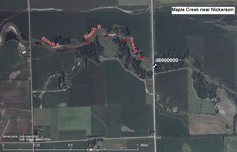
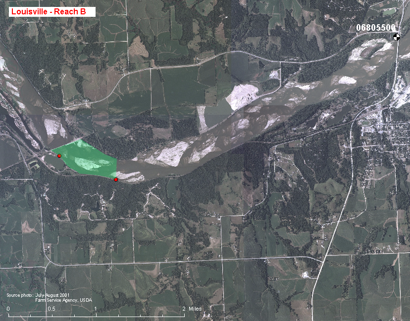
Central Nebraska Basins NAWQA Study UnitWater-Quality Trends in StreamsKeywords: water quality, streams, water chemistry, stream ecology, temporal trends, Platte River The surface-water trends component of NAWQA is intended to identify significant time trends in water-quality conditions in streams through long-term monitoring from 2002 through 2010, which can enable resource managers and policymakers to assess the value of programs such as conservation, farming practices, and planned urban growth. Data are being collected at two surface-water trends stations in the study unit (map) where NAWQA monitoring began in 1992. Maple Creek near Nickerson (USGS station number 06800000) represents agricultural production of corn and soybeans. Its drainage area of 370 mi2 is 85-percent cropland, mostly underlain by fine-textured soils that produce its runoff event-dominated hydrology. The other surface-water trends station represents the effects of mixed land uses across large drainage basins. The Platte River at Louisville (USGS station number 06805500) is downstream from the confluence of the Platte River with the Elkhorn River and integrates the water quality of the entire Platte River Basin. Mean annual streamflow from its drainage area of 85,400 mi2 is 7,160 ft3/s (cubic feet per second), or 5.19 million acre-feet. Within the study unit, the Platte River drains chiefly cropland (36 percent) and pasture and rangeland (54 percent). Present data collection activities
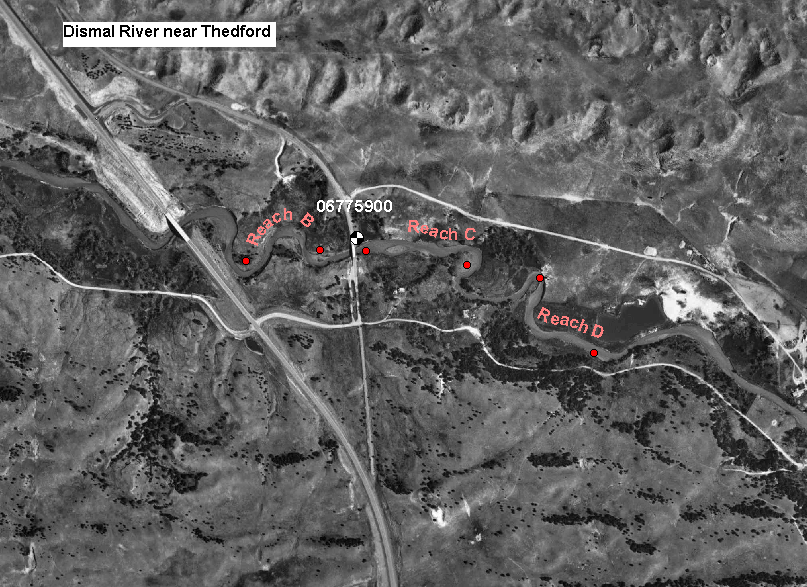
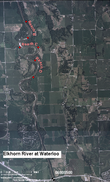
Future reportsA series of reports are planned that will incorporate the most recent data collected at surface-water trends stations over large areas that include the Central Nebraska Basins study area. The first will test for trends in nutrient and sediment concentrations over the last 15 to 20 years at selected sites distributed throughout the Missouri River Basin, and is planned for release in October 2006. A second report will explore biotic responses to a series of environmental gradients in the Great Plains, and is planned for release in October 2007. A third report that summarizes pesticide concentrations in streams of the Corn Belt of the U.S. is yet in its early planning stage. Data collection activities during the intensive sampling periodIntensive sampling occurred from 2002 through 2004 at the two trends stations already listed as well as at two other sites where sampling was discontinued in 2005. The Dismal River near Thedford (USGS station number 06775900) represents grazing of mostly undeveloped grassland in the Sand Hills region. Because overland flow is minimal and base flow is maintained by ground-water discharge from the High Plains aquifer system, streamflow varies little. With just 3 percent of its drainage area used for cropland, effects of agriculture on stream-water quality are minimal. The Elkhorn River at Waterloo (USGS station number 06800500) is located immediately upstream from the confluence of the Elkhorn and Platte Rivers. Principal land uses in this drainage area of 6,900 mi2 are cropland (56 percent) and pasture and rangeland (33 percent). Continuous monitoring of water quality occurred during the growing seasons of 2002 and 2003 at all four surface-water trends stations. Specific conductance, water temperature, pH, and dissolved oxygen were monitored at three stations. Continuous monitoring at the Platte River at Louisville was limited to specific conductance and temperature, because the single monitoring point may not be representative of the highly varied conditions across the channel. Between 12 and 18 water samples were collected annually from 2002 through 2004 at the four surface-water trends stations. Samples were submitted for laboratory analyses of chloride, sulfate, nutrients, organic carbon, pesticides, and suspended sediment. As part of the Agricultural Chemicals Topical Study, an additional 12 samples were collected at Maple Creek near Nickerson. Ecological monitoring at the four trends sites also occurred annually from 2002-2004, with additional ecological samples collected for Maple Creek during 2004 as part of the Nutrient Enrichment Topical Study. Back to Study Activities |

![]() U.S. Department of the Interior |
U.S. Geological Survey
U.S. Department of the Interior |
U.S. Geological Survey
URL: http://ne.water.usgs.gov/Nawqa/www_sw_trends.html
Page Contact Information: GS-W-NE_Webmaster
Page Last Modified: Tuesday, 04-Feb-2014 08:37:44 EST


 Water-quality monitoring is presently being conducted at a relatively low intensity. Bimonthly water sampling is done at both stations, and water samples are sent for laboratory analyses of chloride, sulfate, nutrients, pesticides, and suspended sediment. Ecological monitoring at the two trends sites includes NAWQAs standard ecological reach assessment: samples of fish, invertebrate, and algal communities; and habitat characterization. Annual sampling for algal and invertebrate community assessments and habitat assessments is done during low-flow conditions in the late summer, whereas samples for fish community assessments are collected biannually.
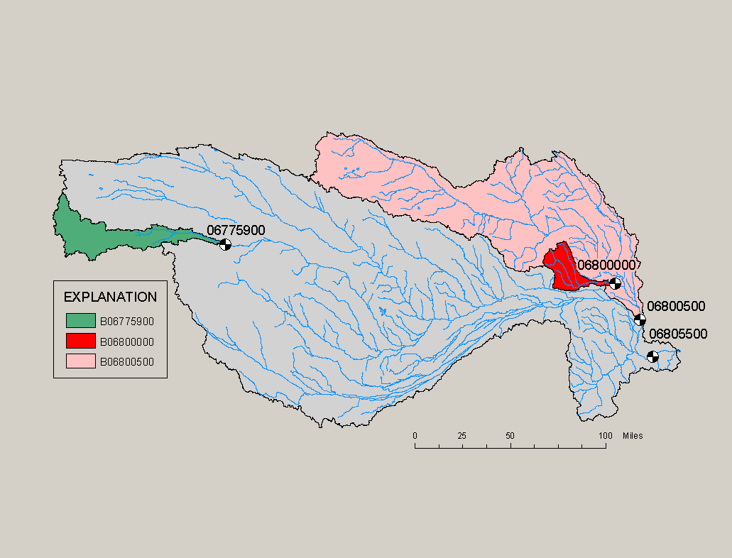