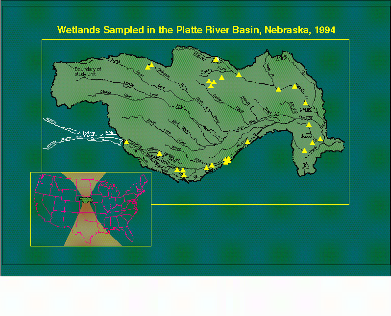
The National Water-Quality Assessment Program of the U.S. Geological Survey is a multi- disciplinary long-term approach to evaluating the Nation's water quality. The Central Nebraska River Basins study unit is one of twenty study units established in 1991 to accomplish the program's objectives. The study unit comprises nearly 78,000 square kilometers in the Platte River Basin from North Platte, downstream to the confluence with the Missouri River near Omaha.
Wetland water quality can not be adequately described without studying the characteristics of the water column, bed sediments, and biota. This presentation describes the techniques and methods used at selected wetlands in the Central Nebraska study unit.
The Central Nebraska Basins Study Unit lies entirely within the Central Flyway migratory route and its network of rivers and wetlands provides staging and nesting areas for migratory birds. Monitoring the health of these wetlands was determined to be an essential responsibility of the study unit. Other researchers have noted the lack of systematic methods of wetlands monitoring and repeatable methods of sampling these wetlands had to be developed.
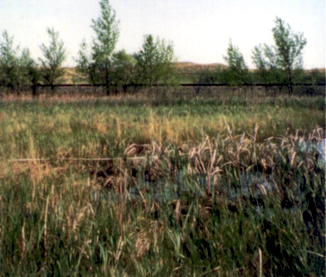 A wetland constructed by the Nebraska Department of Roads in the Sandhills region and just south of the Dismal River in the western third of the study area. The Sandhills comprise the world's second largest area of sand dunes. Land use is almost exclusively ranching, but valleys between the dunes frequently have marshes and shallow lakes.
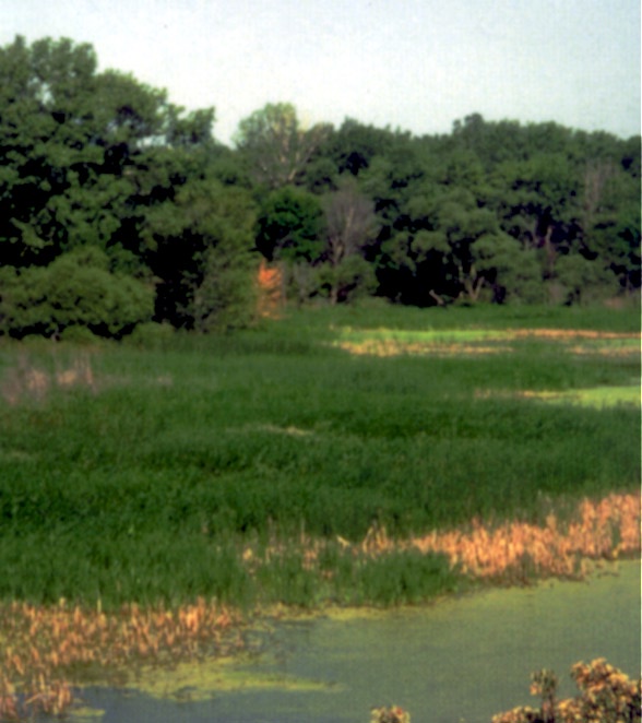
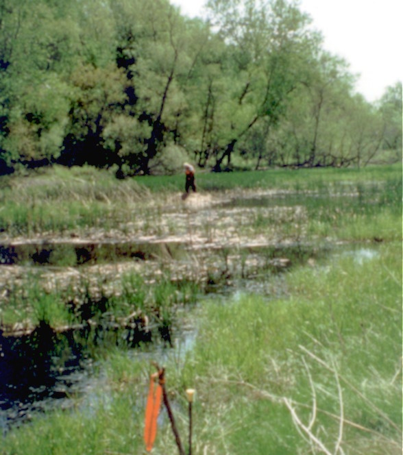
 A slough and wet meadow on Mormon Island of the Platte River just south of Grand Island. This is one of the wetlands where waterfowl converge on the Critical Habitat Reach of the Platte River twice each year in their migratory route.
 Many wetlands in Nebraska are appreciated for their value as waterfowl habitat. These Wildlife Management Areas are managed by the Nebraska Game and Parks Commission. Other potential benefits of wetlands to society are now beginning to be recognized.
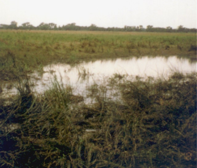
 Black Island Wildlife Management Area was formed by an abandoned river channel of the Elkhorn River in the northeastern region of the study area. Land use in the area is predominately row crop agriculture.
![]()
Wetland transect showing water quality, bed sediment, and plant sampling lines.
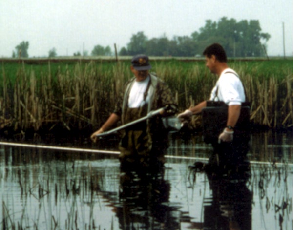
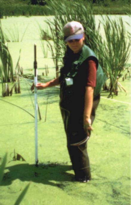
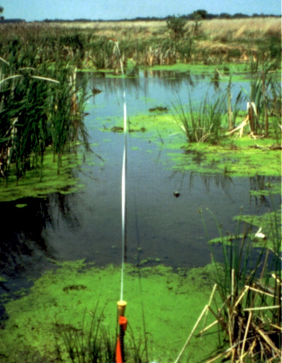 The transect line laid out across a wetland near Kearney, Nebraska. The fiberglass measuring tape was deployed well away from the transect line and moved to the terminal iron pins. Field measurements with global positioning system equipment determined a latitude and longitude for the pins. Azimuth and distance between the two pins was recorded and ten equidistant sampling positions determined.
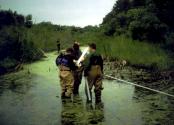
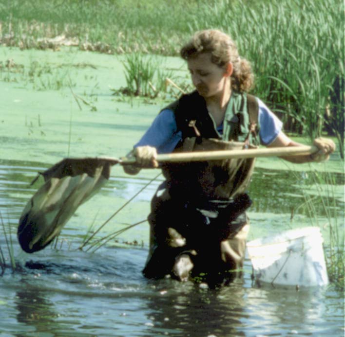
 Field personnel collecting water-column samples along the transect with a PTFE well bailer. At each of 10 equidistant points, 300 to 500 milliliters of water was collected and composited in a glass container.
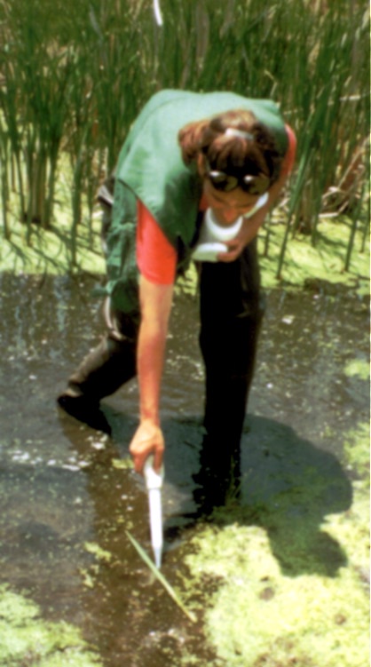
 The PTFE well bailer being used to collect a water column sample in shallow water. Field personnel collected undisturbed samples in water as shallow as two centimeters. A 60 cubic-centimeter plastic syringe was used where water was less than two centimeters deep.
 Field personnel extracting a bed core from the PTFE pipe sampler for trace-element analysis. Bed material was wet sieved through a 63 micron nylon-mesh sieve for trace-element analysis.
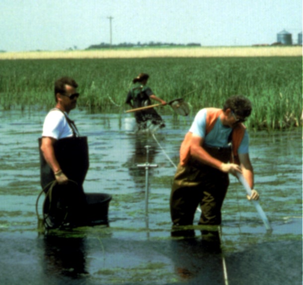
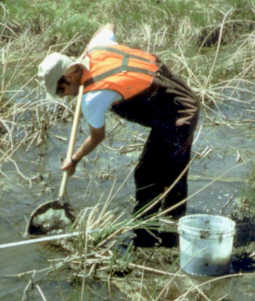
 Crew collecting bed core samples to be analyzed for nutrients and triazine herbicides using a USGS BMH-53 sampler. The samples were composited into a glass bowl and thoroughly mixed. Sediments were processed using a two millimeter stainless-steel sieve for nutrient and triazine herbicide analysis.
 The PTFE well bailer being used to collect vertical columns of wetland water for phytoplankton community and chlorophyll-a analysis. Approximately 100 milliliters was collected and composited from each of the 10 equidistant points, of which half was retained to be processed for chlorophyll-a analysis and the rest preserved with buffered formalin for identification and enumeration of phytoplankton.
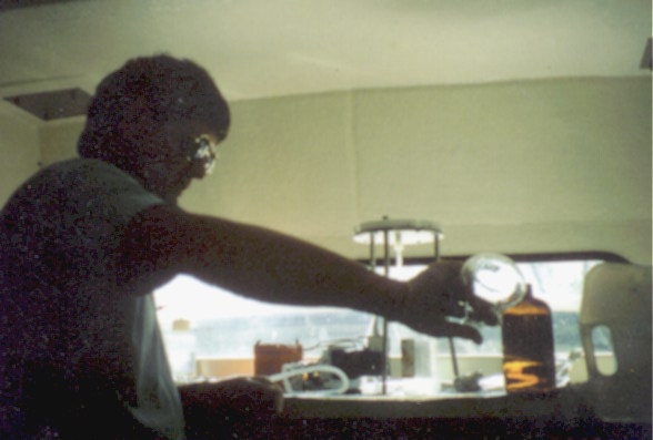 U.S. Geological Survey ecologists processed and preserved the samples on-site in mobile laboratory facilities. Field personnel modified the U.S. Geological Survey's "parts per billion" protocol for sample collection and preservation to use in wetlands.
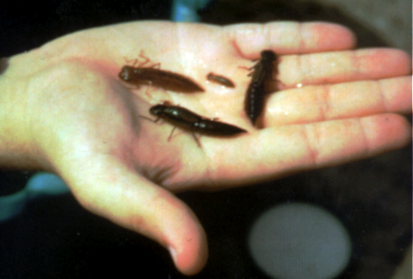 Odonate nymphs are large in mass, relatively long lived, and live in close proximity to bottom sediments and organic litter.
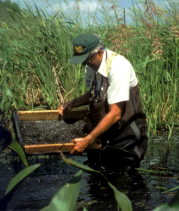 The U.S. Geological Survey National Water Quality Laboratory requires 10 grams of tissue (dry weight) for a full trace-element analysis. This requirement necessitated a method for gathering a lot of nymphs quickly. Fiberglass screen was stretched over a wooden frame to sieve bed material and organic litter from the nymphs.
 Crews collected a qualitative macroinvertebrate sample by sweeping with a 210-micron D-frame kick net and hand picking undisturbed areas adjacent to the sampling transect.
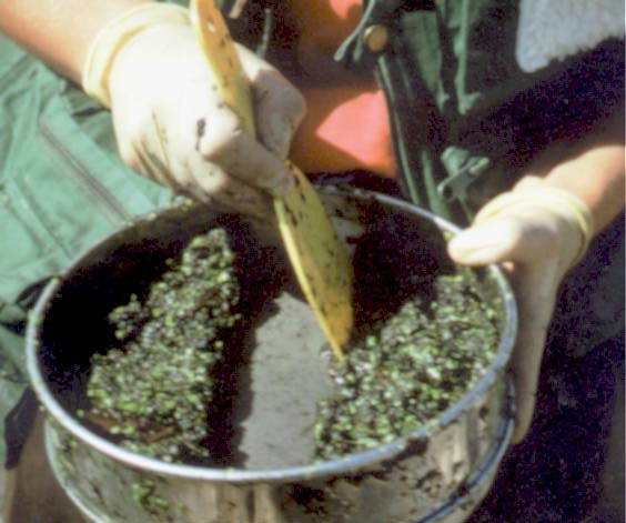 An ecologist reduces the macroinvertebrate sample by splitting the processed material in a 212-micron sieve. Large and rare specimens are picked and preserved separately. Biological samples are preserved in 10 percent buffered formalin.
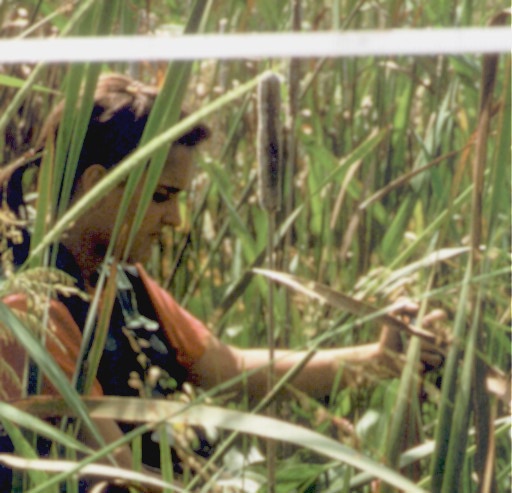
The aquatic plant community is described by the point intercept method. A pointed rod is lowered to the bed at each sampling point along the plant community transects. The species of emergent, submergent, or floating macrophytes are identified at each of these points. If no plants are encountered at the sampling point, that location is recorded as open water. Unknown plants are preserved by drying and pressing in the field for later identification.
 Qualitative algal samples were collected from all available habitats with forceps, hand picking, bulb syringe, scraping, and squeezing. Wetland algal and invertebrate samples are standardized by establishing an equal work effort for all sites of 30 minutes.
Qualitative sampling of macroinvertebrates, benthic and planktonic algae, and the macrophyte communities will establish species lists for wetlands in Nebraska. Analysis of the biological data in conjunction with physical and chemical data will identify patterns in community composition and the factors that most strongly influence the biota.
Central Nebraska River Basins Study Unit
U.S. Geological Survey, WRD
4821 Quail Crest Place
Lawrence , KS 66049
OR
Nebraska District Chief
U.S. Geological Survey, WRD
Rm. 406, Denny Federal Bldg.
Lincoln, NE 68508
Central Nebraska Basins NAWQA home page
Any questions, comments, or suggestions?
Contact <[email protected]>
Last modified: Aug. 11, 1995